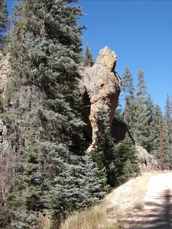
 A vertical column of rock in Sulfur Creek canyon. Photo by Bob Dryja
 PEEC Amateur Naturalist: A small patch of Yellowstone in New Mexico
By Robert Dryja
The Valles Caldera is approximately thirteen miles across. It is so large that several volcanic peaks rose up in it after its creation 1.2 million years ago.
Hot lava still exists beneath the caldera. This is most evident areas that have warm springs and ponds that are bubbling with hydrogen sulfide and carbon dioxide gases. The water can be acidic and the smell of rotten eggs fills the nearby air. The areas are like Yellowstone National Park albeit on a small scale.
Some canyons have slopes with a distinctively greyish, rocky surface where few trees grow. The forest growing immediately adjacent to these slopes looks luxurious in comparison. Grasses and other plants are not growing particularly well by some ponds. Gases are seeping up through the soil beneath the trees or bubbling up in the ponds, making life difficult.
There are two contrasting canyons. The Sulfur Creek Canyon is narrow with steep sides. There are massive, vertical columns of stone along it. A large pit is located in it. It is the remnant of a surface mine for sulfur. The Sulfur Springs mine has been closed for years but abandoned buildings and equipment remain. An artificial pond and a fumarole are located here, bubbling with gases and smelling of rotten eggs. The surrounding canyon slopes have the greyish rocky surfaces that indicate gases are coming through the soil.
The sulfur mine area looks like an ecological disaster, nearly one hundred years after the mining occurred. This is particularly so because it is surrounded by the healthy forest of the Valles Caldera. A distinction needs to be made however between what is happening through natural processes and what is a result of the mining operation.
Even if the mining area were restored, the surrounding canyon slopes still would show the geothermal impact of the volcanism occurring deep underground. A sense of what the sulfur mine area could look like after restoration can be seen at Alamo Canyon where it joins with the Sulfur Creek Canyon. Once again trees are dispersed among grayish-white rock rubble that extends from the canyon slope to the valley floor.
Alamo Canyon contrasts sharply with Sulfur Creek Canyon. Alamo Canyon is a broad, meadow-like valley in which grasses and herbaceous plants dominate. A prairie dog colony is located here. A maturing forest of conifers and aspen eventually appear on its adjacent slopes. Alamo Canyon proceeds gently upwards over a distance of three miles as it moves away from Sulfur Creek Canyon. Forest then replaces the grassy meadowlands at its upper end. The Alamo Canyon meadowlands are part of a fen.
Water not only flows on the surface in a stream, it also moves underground, following the gentle slope of Alamo Canyon. Ponds and marsh areas occur repeatedly along the way where water rises to the surface.
The impact of geothermal drilling is more subtle in Alamo canyon, unlike at the sulfur mine. There are two drilling sites that now are covered with grasses. One site has a grayish-white rocky slope similar to the other canyon slopes. This may be natural or the result of the drilling. The level ground surface and capped drill pipes are the only immediately obvious indicators that some type of engineering occurred here.
An even more subtle manmade influence occurs with three ponds spread out in a row along the canyon. A stream connects between the ponds as it flows down Alamo Canyon. The first pond at the downward end of the canyon is the deepest and its water is turquoise blue in color.
Grasses grow along its shore as well as conifer trees. The turquoise color indicates that gases are dissolving into the water. Bubbles can be seen when walking along its shore line. The plants and algae evidently are adapted to some level of acidity or the water is not that acidic to start. An earthen dam on the down steam side of the pond is the only indication that this pond is not a pleasant natural feature—it actually is manmade.
The second pond going up the canyon also is a result of a dam. However it is much shallower compared to the first pond. A line of grasses grows in the water and separates the pond into two halves.
The water in the upstream half is relatively clear and patches of grass grow in it. The water in the downstream half in contrast has a milky, somewhat turquoise color. Gas bubbles can be seen and an unusual purplish-colored algae grows in this half of the pond. The shore line for the downstream part of the pond is adjacent to a field grayish-white rock and sand, similar to what is seen at the sulfur mine.
The second pond therefore gives the impression that it is in a transition area. Geothermal activity begins in the lower half of the pond while the upper half is not affected.
The third pond is toward the upper end of Alamo canyon and it is the shallowest. It appears to be a naturally occurring feature since no dam is present. The water is clear, grasses grow around it, and there is no obvious gas bubbling. This gives the impression that the upper end of Alamo Canyon is beyond the active geothermal area of the Valles Caldera.
Alamo Canyon presents a unique variation for the ponds and streams in the Valles Caldera. It is the one canyon that contains a fen due in part to its gentle slope and broad base. The peat in this fen is from six to sixteen feet deep. Carbon 14 dating of peat samples indicates that some areas are 9,000 years old.
The gases resulting from geothermal activity are special to this canyon, affecting the acidity of its water.
The acidic peat bogs of Europe are known for their preserved plant, animal and human remains. Alamo Canyon may contain a preserved biologic history for northern New Mexico that reaches back to the last ice age.
Exploring down the Rabbit Hole —Learning more like Alice
Watch videos about the creation of the Valles Caldera and the movement of water through it at the following links:
Read about the fens of Alamo Canyon starting at page 59 of the following document:
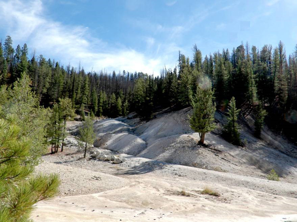 Gases rise up in the slopes adjacent to the Sulfur Creek mine, stunting tree growth. Sulfur mining occurred at the lower levels. Photo by Bob Dryja
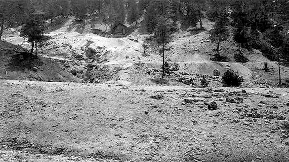 The Sulfur Creek mine area in 1918. Photo by Bob Dryja
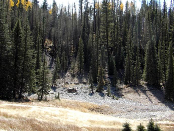 Greyish rock rubble occurs at the start of Alamo Canyon and is similar to slopes at the mine on Sulfur Creek. Photo by Bob Dryja
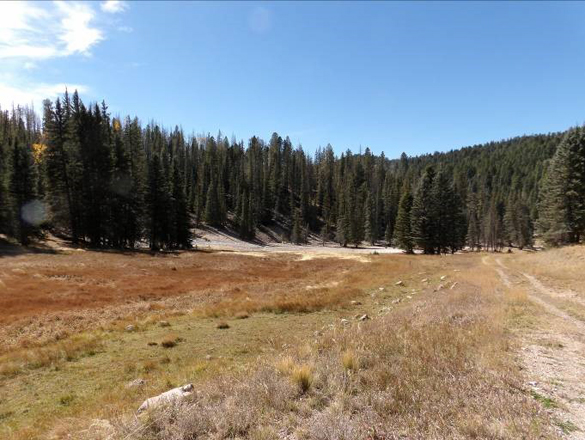 Alamo Canyon changes into a broad meadow when going upstream from its rocky junction with Sulfur Creek. Photo by Bob Dryja
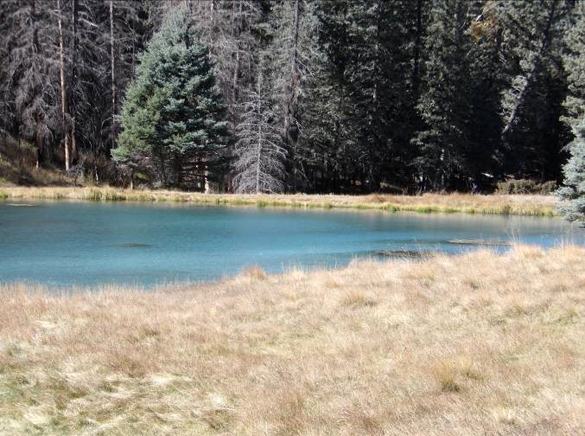 A turquoise colored pond at the start of Alamo Canyon is due to the dissolved geothermal gases in its water. Photo by Bob Dryja
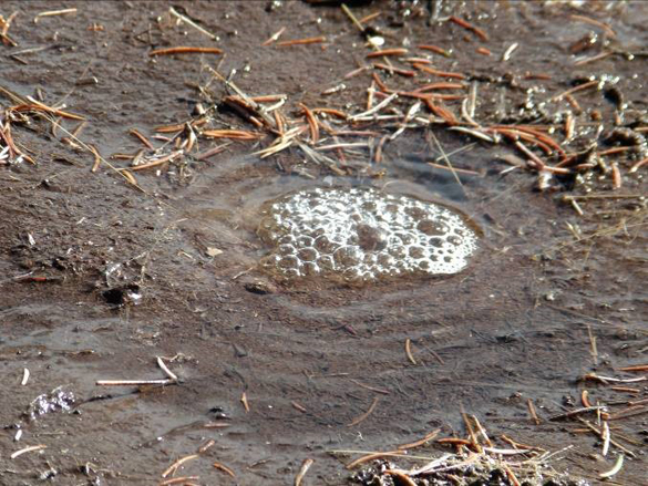 Gases bubbling to the surface of the pond. Photo by Bob Dryja
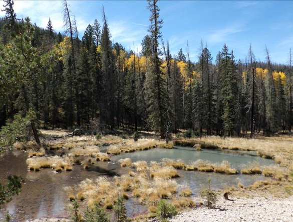 The water of the second pond is clear for upstream side while becoming turquoise blue on the downstream side. Photo by Bob Dryja
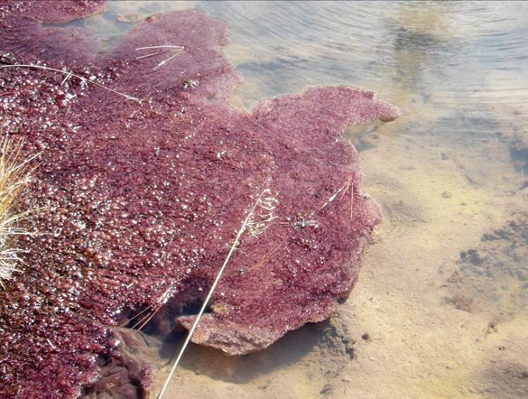 A purple algae grows in the downstream section of the second pond. The water becomes a milky turquoise color here, suggesting acidity is developing. Photo by Bob Dryja
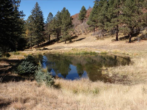 The third pond is not affected by geothermal activity. Its water is clear. Photo by Bob Dryja
