
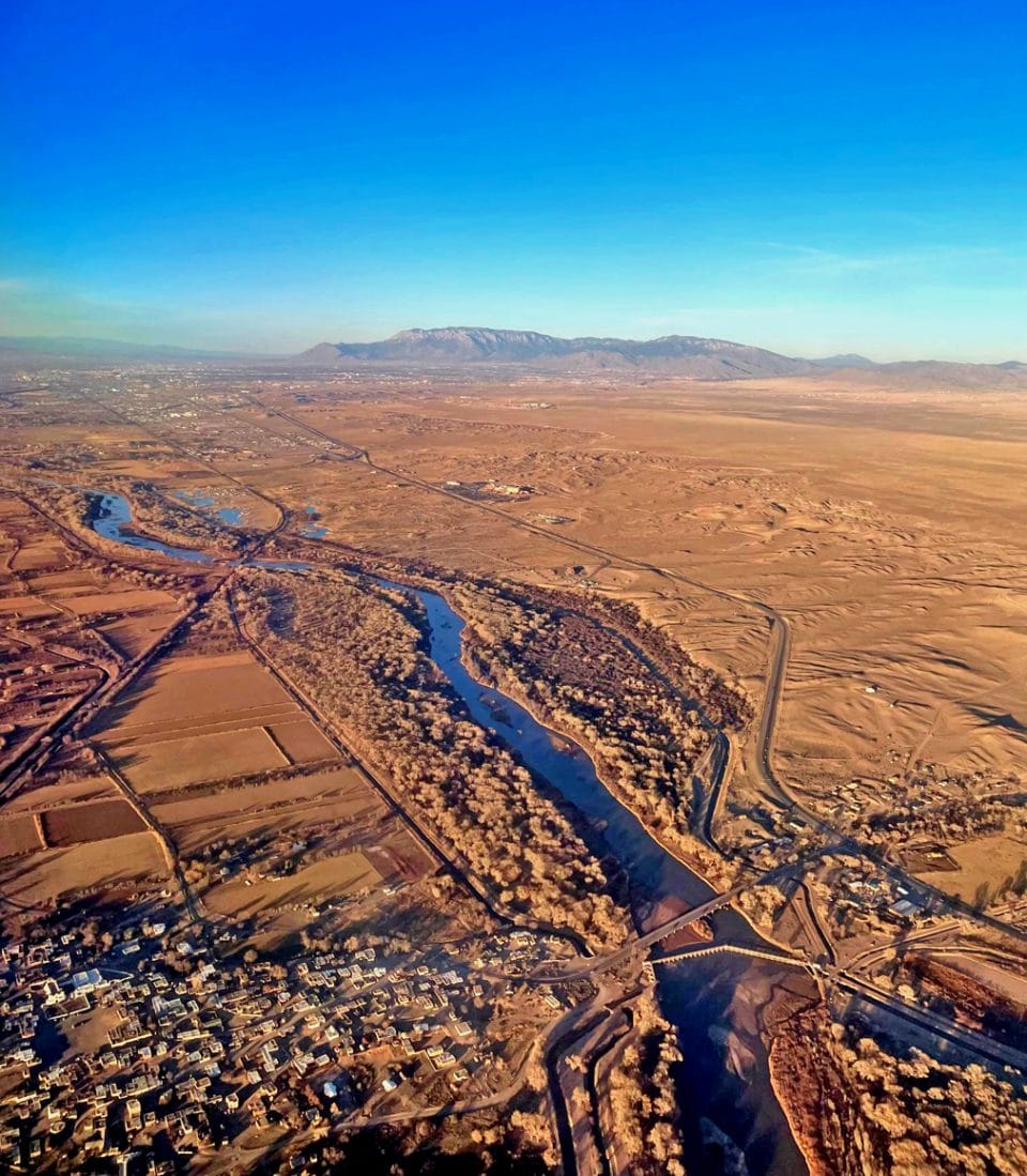
 View looking north up the Rio Grande as it flows past Albuquerque – the contrast between the thin blue line of the flowing waters and the burnt-clay colors of the sloping lands both east and west of the river is a defining image of what the Rio Grande has meant for the peoples of these lands. Courtesy/Terry Wallace
By TERRY WALLACE
Los Alamos
The thin ribbon of life: The Rio Grande. No natural feature defines New Mexico more clearly than the Rio Grande River. Although the river is quite modest in terms of water flow, it has provided the life-blood of the arid lands of New Mexico for thousands of year.
The Rio Grande enters the state just east of Antonio, Colorado, and follows the geological scar of the Rio Grande Rift all the way to El Paso, Texas. For most of the history of New Mexico, the vast majority of the population has lived within 50 miles of the river.
The first picture above is an image looking north up the Rio Grande as it flows past Albuquerque – the contrast between the thin blue line of the flowing waters and the burnt-clay colors of the sloping lands both east and west of the river is a defining imagine of what the Rio Grande has meant for the peoples of these lands.
The Rio Grande drainage basin covers about 500,000 km2 (figure 2 below). The Rio Grande “officially” starts high on the eastern flank of Canby Mountain, a mile or so from Stony Pass – an old mining supply route connecting Silverton, and Creede, Colorado.
The third picture (below) is the first visible flowing waters (I took this picture in June, 2017) – eventually these waters will travel some 3,000 km to the Gulf of Mexico. Although the Rio Grande begins with much promise as it collects tributaries like the Chama, Taos and Jemez rivers, for more than one half of its journey through the state there are no additive water sources, only sinks. Today the Rio Grande is dry for approximately 6 months a year when it reaches El Paso.
The fight over the use of the Rio Grande water – a battle between Colorado, New Mexico and Texas, along with commitments to Mexico – is filled with lawyers, thirst farmers, and a dying ecosystem.
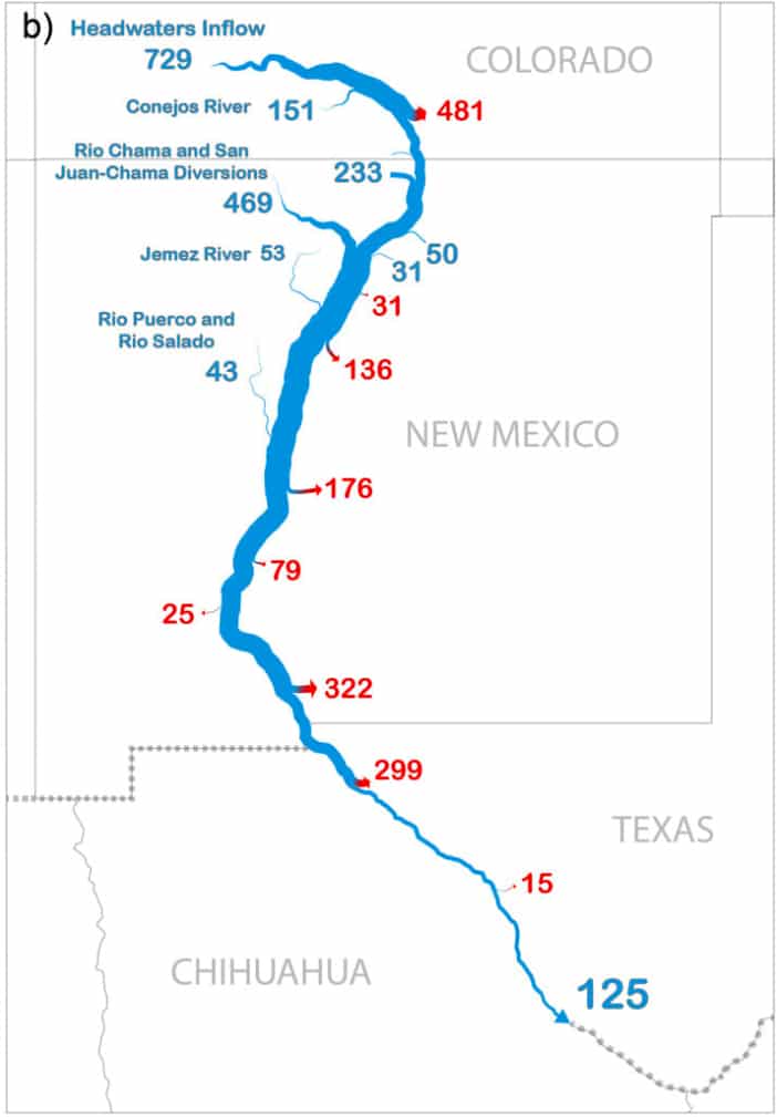
The fourth figure (below), from an AGU paper (Blythe and Schmidt, 2018) on nature of water flows in the Rio Grande shows a comparison of what the “natural” flow of the river sans human activity and the actual flow for the most recent 10 year average. Shown on the map are tributary inputs in blue and diversions (irrigation and water withdrawal for urban use) in red. The simplest summary: there is no more water. The Otowi river flow gauge is one of the most important measurements for both the health of the river and the legal requirements of the water divisions. The gauge is 10 miles from my house as the crow flies, and I pass it every time to leave or come home to Los Alamos.
The final figure (below) shows the flows: historically the annual flow is 1.8 million acre feet (purple are the inferred historical values, and the orange is the measure flow 1971-2007). When more than 1.1 million acre feet level is reached then New Mexico can use its allotment of water. If it drops below, then water must be released from reservoirs downstream. What is remarkable about the flow is the extraordinary variability – almost 60%! Our view into nature is through what we see in a day, or month or year, or maybe a decade. It means little to what is happening on time scales of a century or millennia. #huttonproject
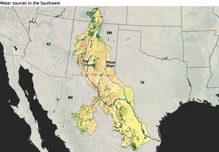 Figure 2: The Rio Grande drainage basin covers about 500,000 km2. Courtesy/Terry Wallace
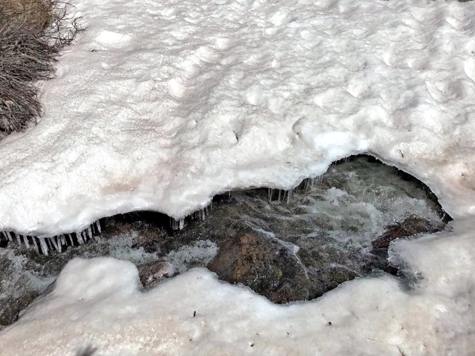 Picture 3: The first visible flowing waters (photo taken June 2017), eventually these waters will travel some 3,000 km to the Gulf of Mexico. Photo by Terry Wallace
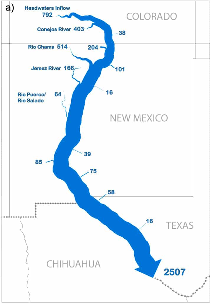 Figure 4: This figure from an AGU paper (Blythe and Schmidt, 2018) on nature of water flows in the Rio Grande shows a comparison of what the ‘natural’ flow of the river sans human activity and the actual flow for the most recent 10 year average. Shown on this map are tributary inputs in blue and diversions (irrigation and water withdrawal for urban use) in red. Courtesy/Terry Wallace
 Final figure: This shows the flows: historically the annual flow is 1.8 million acre feet (purple are the inferred historical values, and the orange is the measure flow 1971-2007). Courtesy/Terry Wallace