
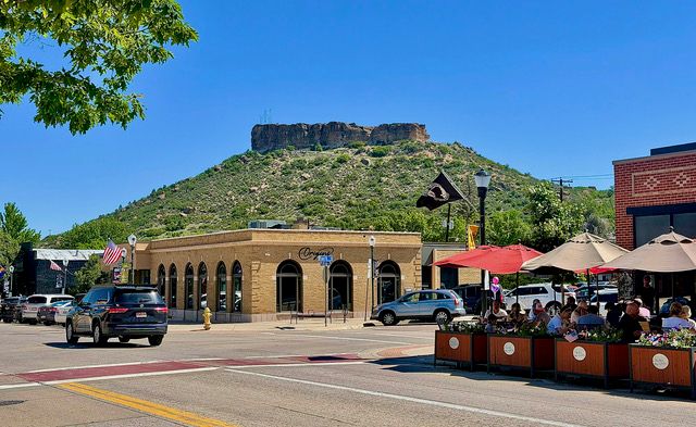
 Castle Rock: Shown is the actual castle rock as seen from downtown Castle Rock, Colo. The rock is a prominent landmark from which the city is named. Rock Park covers the land where the rock sits and has become a popular hiking destination for hikers. The views seen from the rock are spectacular. Photo by Gary Warren/ladailypost.com
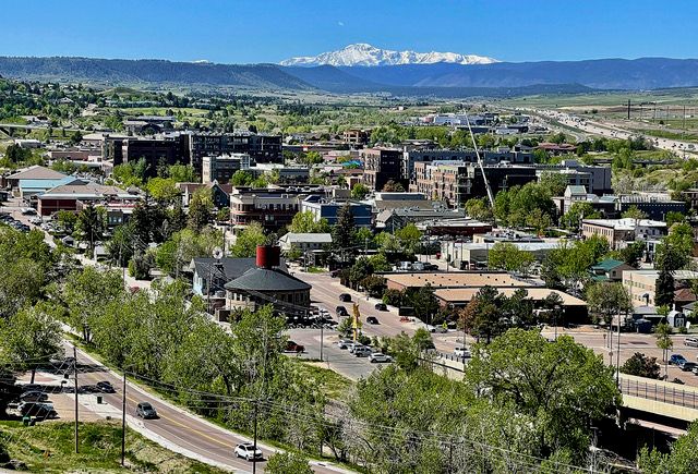 Downtown Castle Rock: Downtown Castle Rock is viewed from the castle rock and is just blocks south of the rock landmark. Pikes Peak stands tall in Colorado Springs to the south. Interstate 25, which can be seen on the right side of the photo, passes through Castle Rock on its way north to Denver. Castle Rock was founded in the 1800s but in recent years has seen a huge growth in population and commerce. Castle Rock has long been a nice stopping point as it is about halfway between Colorado Springs and Denver. Photo by Gary Warren/ladailypost.com
By GARY WARREN
Photographer
Formerly of Los Alamos
After living in Highlands Ranch, Colo. for more than 15 years we moved a few miles south three years ago to Castle Rock. The city is the county seat of Douglas County and known as one of the fastest growing small cities in the country.
The population of Castle Rock was about 20,000 in the year 2000. By 2023, the population had risen to more than 70,000 and today it is estimated to be well over 80,000.
Castle Rock was set up in the 1870s and became a town when the railroad arrived in 1881. The first settlers in the area were farmers and mining personnel. There were rumors of gold and silver mining in the area, but those minerals were not found. What was discovered is an abundance of rhyolite.
Rhyolite is a volcanic rock that is resistant to erosion and easy to form into blocks for building structures. Multiple rhyolite quarries were established around the area and for about 35 years rhyolite was shipped from Wyoming to New Mexico and extensively in Colorado. During those years Castle Rock was born.
Castle Rock does indeed have a “castle rock”, which became the namesake of the town. Today the “castle rock” is owned by the city and is a popular area for hiking. Sitting just blocks north of downtown Castle Rock the beautiful geologic formation is indeed a local landmark just as it has been throughout the town’s existence.
The area of the castle rock is now officially known as Rock Park and there are a few different trail routes which lead to the base of the rhyolite cap rock of the formation. The rhyolite cap is a butte that sits on top of millions of years of sediment, which has formed the hill around the rock.
The base area allows hikers to move around the cap rock and enjoy spectacular views of town from every direction. Climbing to the top of the rock from the base of the cap rock is no longer allowed for safety reasons. However, there is a U.S. flag, which can be seen from town as well as a large star shaped frame that is lit every year for the holiday season.
Castle Rock is fortunate to sit in a beautiful landscape that provides ample outdoor trails for hiking and biking. The town is built in and around a hilly terrain with many ridges and buttes to explore and enjoy. Great outdoor opportunities abound but one of the most popular is the 1.5 round trip hike up a few hundred feet on “the castle rock”! Enjoy the view!
Editor’s note: Longtime Los Alamos photographer Gary Warren and his wife Marilyn are traveling around the country, and he shares his photographs, which appear in the “Posts from the Road” series published in the Sunday edition of the Los Alamos Daily Post.
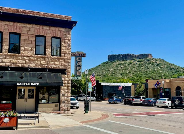 Castle Cafe: The Castle Cafe building in downtown Castle Rock was built in 1901 and is constructed using rhyolite rock on the exterior. Rhyolite was quarry mined for many years after the town was settled and used in many of the historic buildings and houses in Castle Rock. Photo by Gary Warren/ladailypost.com
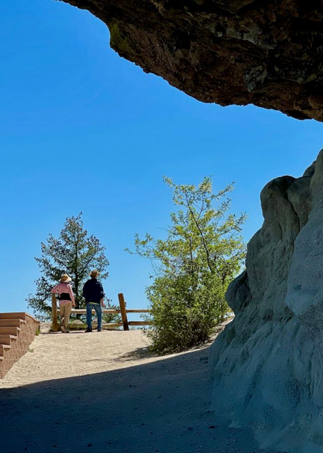 Enjoy the View: A couple of hikers enjoy views from the base of the cap rock at Rock Park in Castle Rock. Seen is the rock formation as it hangs over a portion of the walkway which leads hikers around the rock for views in every direction. Photo by Gary Warren/ladailypost.com
 Playing Around: Adults look on as a group of children enjoy playing on a portion of the rock at the base of the cap rock at Rock Park. The hike to this area is 1.5 miles round trip and can be hiked by hikers of all ages. Photo by Gary Warren/ladailypost.com
 View from Trail: This is a view from the trail looking up toward the top of the castle rock. The hike leads around a portion of the rock formation as it gains elevation along the way. The view from the trail gives hikers an up-close perspective of the hillside and rock formation. Photo by Gary Warren/ladailypost.com
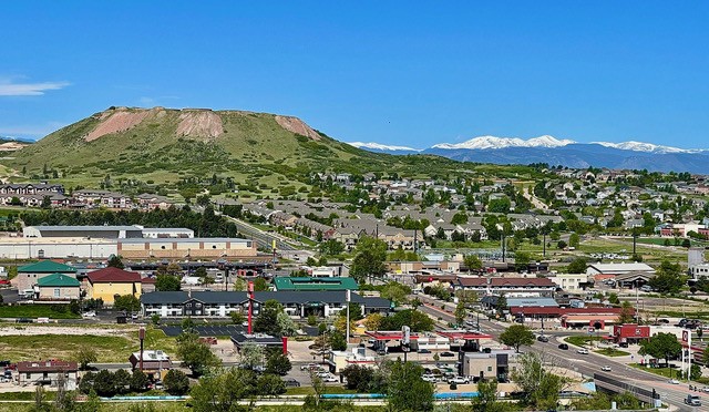 Mountain View: A view from the rock toward the west offers beautiful views of the Rocky Mountains west of Castle Rock. The mesa in the foreground is one of several seen around the city of Castle Rock. The view of town looking west shows some commercial properties in the foreground across I-25 from the rock and a large housing area beyond. Photo by Gary Warren/ladailypost.com
 View to East: A view to the east from the castle rock gives hikers a view of some open space as well as several housing communities. Real estate has exploded in the past few years as Castle Rock has become one of the fastest growing cities in the nation. On the other side of the ridge seen in this photo, housing and development spreads far to the east of town. Photo by Gary Warren/ladailypost.com