
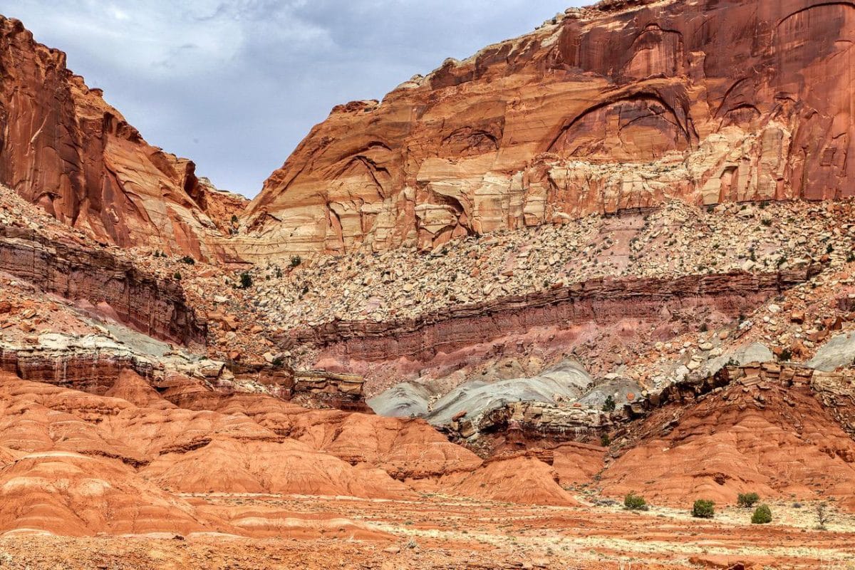
 Color and Design: The various red colors from rose to orange to red with layers of yellow mixed in create a beautiful design on this rock cliff near the entrance to Capitol Reef National Park. Photo by Gary Warren/ladailypost.com
 Fremont River: The Fremont River travels along Scenic Byway 24 and adds opportunity for trees and other vegetation to grow in the canyon near Capitol Reef National Park. The beautiful red rocks can be seen for miles as you travel the route. Photo by Gary Warren/ladailypost.com
By GARY WARREN
Photographer
Formerly of Los Alamos
We have spent about three weeks “roaming” around Southern Utah. With no specific route or plans, we entered Utah via Interstate 15 at St. George, Utah and moved around the southern part of the state. To say that Southern Utah displays some of the most magnificent landscapes is an understatement. There seems to be jaw-dropping views around every bend in the road.
This post will feature one of several Scenic Byways that are found in this part of Utah, Scenic Byway 24. A simple name for a beautiful drive of about 75 miles from Loa, Utah to Hanksville, Utah. Our “basecamp” was in Hanksville, and we explored from there.
The drive that we took from Hanksville to Torrey covers the majority of the Scenic Byway. As you leave Hanksville, the landscape is nice, high desert, but vegetation is not the star of the show, there just isn’t much of it!
However, driving westward on Highway 24 the scenery begins to change and the magical geographic wonders make their selves the reason that this highway is a Scenic Byway. Beautiful rock formations of several colors begin to show but the dominant color is red. This is red rock country.
Scenic Byway 24 really takes on magnificence as you drive through the canyon toward the farming community of Fruita, Utah. Fruita was settled by the Mormons over 100 years ago. They built some structures and houses and planted over 3,000 fruit trees in the valley near the Fremont River which still exist today. The primary entrance to Capitol Reef National Park and the park’s visitor center are the next landmarks just past the orchards at Fruita.
After passing the entrance to Capitol Reef, the landscape opens up a bit into the Fremont River Valley. While the canyon has opened up, the views and landscape are just as impressive as you drive along the red rocks and formations for a few miles into Torrey.
Torrey is a small village that has a few restaurants, stores and offers good camping at an elevation of almost 7,000 feet. Torrey can be a great escape from hot desert temperatures in the summer as the climate is much cooler due to the elevation. Torrey is also the point where Scenic Byways 24 and Scenic Byway 12 meet. As you travel westward on Scenic Byway 24, you drive into the Fishlake National Forest.
We took a break at Torrey for a while and then began our drive back to Hanksville. Driving the same road but from west to east revealed many additional fabulous red rock landscapes and vistas. This is just one of several scenic drives that we enjoyed while roaming around Southern Utah.
This entire scenic drive offers a variety of outdoor recreation opportunities. Hiking the many trails is an obvious example. Other activities such as photography, bird watching near the river, biking, and camping are just a few of the outdoor opportunities as you travel and admire this amazing and beautiful part of Utah.
Editor’s note: Longtime Los Alamos photographer Gary Warren and his wife Marilyn are traveling around the country, and he shares his photographs, which appear in the “Posts from the Road” series published in the Sunday edition of the Los Alamos Daily Post.
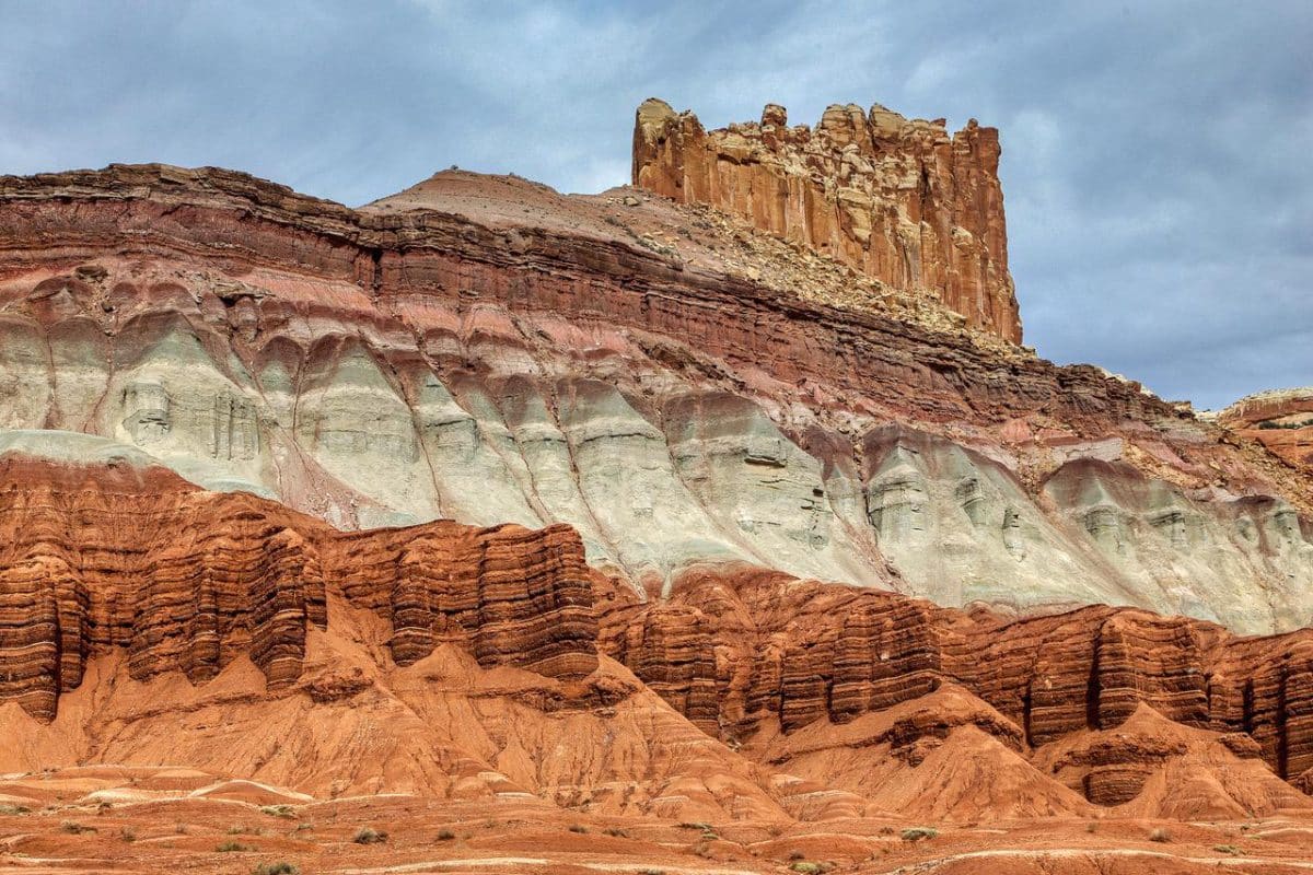 The Castle: This formation just west of Capitol Reef is known as the Castle. The formation does look like a castle as you view it from different angles. Again, the colors of the rock formations create an incredible view for visitors. The lower red layer swirls around in every direction and then levels out to horizontal layers as it progresses up toward the Castle which is made up of very vertical spires. Photo by Gary Warren/ladailypost.com
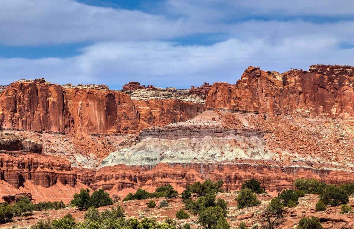
 Torrey: The landscape near Torrey changes a bit as the valley opens up but the red rock formations continue to amaze viewers. The elevation has risen, and Torrey becomes juniper and pinon country before changing to pine, fir, and aspen in the forest higher in elevation. Photo by Gary Warren/ladailypost.com
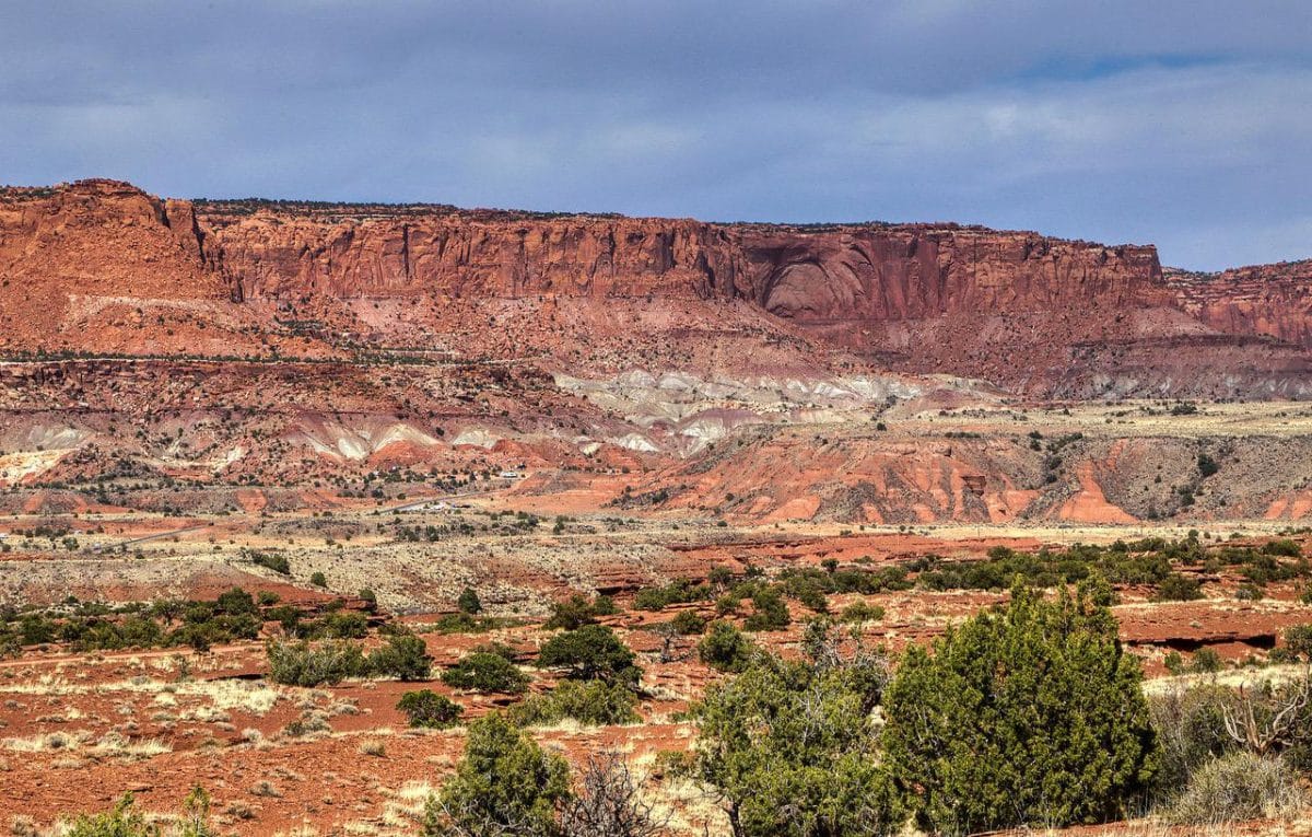
 Fremont River Valley: This scene is part of the Fremont River Valley looking toward the red rock cliffs. The river is in the distance behind the photographer and is not visible in this view. The multi-colored rock cliffs and formations with the pinon and juniper in the foreground are a sight for the eyes! Photo by Gary Warren/ladailypost.com
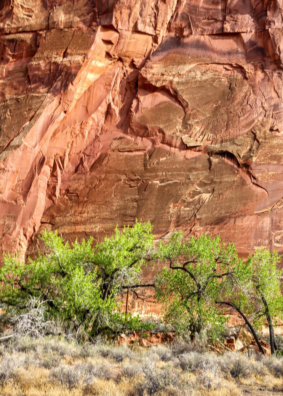 Twisted Trees: These twisted trees along the Fremont River and adjacent rock wall appear to be battling for attention as their dark trunks and branches move about in the new spring growth. The trees were not that small but are dwarfed by the huge red rock canyon wall. Photo by Gary Warren/ladailypost.com