
 Bixby Bridge is an iconic landmark along the Pacific Coast Highway between Monterey and Big Sur, Calif. The bridge crosses Bixby Creek as it flows from the coastal mountains into the Pacific Ocean. The scenic setting makes this a popular landmark for photos as drivers travel the highway. Photo by Gary Warren/ladailypost.com
 A view of the coastline and Bixby Bridge is viewed from the south side of the bridge. There are several overlooks that give visitors a view of the bridge and coast. Photo by Gary Warren/ladailypost.com
By GARY WARREN
Photographer
Formerly of Los Alamos
California Highway 1, the Pacific Coast Highway, is one of the most iconic and popular highways in the U.S. for a road trip. The entire stretch of Highway 1 is 620 miles long covering most of the California coastline.
While in California during a Christmas trip in 2017, we drove and experienced a tiny section of the route. While the miles were few, the area that we drove is probably the most popular and well known of the highway.
We were wrapping up our stay in Santa Cruz and Monterey but before traveling to the southern California for the next portion of the trip we had to drive to Big Sur.
The distance from Monterey to Big Sur is only about 30 miles but drive time can be almost an hour. In addition to that, when you have a photographer in your vehicle that drive can easily become more than two hours or longer in each direction!
We left Monterey on Highway 1 but didn’t get far. We had never been to Point Lobos State Reserve. This area is a small peninsula that protrudes a short distance from the highway out into the Pacific Ocean. We spent some time exploring the coast of the preserve before returning to Highway 1 for the continuation of our drive to Big Sur.
We stopped numerous times along the drive but the one essential stop both going to Big Sur and returning north to Monterey was the stop at Bixby Bridge. The bridge is extraordinary but the setting, views, and always changing coastal weather make this stop more magnificent.
We eventually reached Big Sur and stopped and browsed around the area before beginning our drive back to Monterey. We had considered driving the Pacific Coast Highway south but road construction south of Big Sur had the highway closed. Our drive to the desert would take us to the center of the state through the San Joaquin Valley.
After a few photo stops driving north we arrived back in Monterey. We took a break, got fuel for the RV and began our dive east toward the central valley.
We have traveled several sections of Highway 1 but the stretch of road between Monterey and Big Sur is some of the most beautiful and majestic landscape in the country. It does take longer to drive the coastal highway because of the many curves and the nature of the highway but it also begs for travelers to stop often and experience the views, the coastal breezes, and the smells of the mountains as they collide with the Pacific Ocean.
Looking back at this trip from five years ago has been a trip down memory lane but it has also rekindled my love for traveling the Pacific Coast Highway. This trip still remains one of our favorites after traveling for seven years in our RV from coast to coast.
Our hope is to make a trip covering the entire length of the Pacific Coast Highway at some point. In addition to magnificent views throughout the trip, there are many historical sites and features which we would love to visit as well as many coastal communities which all have their own personal traits and features.
Editor’s note: Longtime Los Alamos photographer Gary Warren and his wife Marilyn are traveling around the country, and he shares his photographs, which appear in the “Posts from the Road” series published in the Sunday edition of the Los Alamos Daily Post.
 The weather is constantly changing along the California coastline. The coast often gets engulfed in fog, which comes and goes in the area. Shown is a view of the coast as foggy conditions begin to overtake the view. Photo by Gary Warren/ladailypost.com
 Point Sur State Historical Park is located at Big Sur on a small peninsula that juts into the ocean. The rocky point is home to a light station where the light house has worked continuously since the station was established in1889. Also at Point Sur is the former Point Sur Naval Facility. All but one building of the former facility is now a part of the state park. Photo by Gary Warren/ladailypost.com
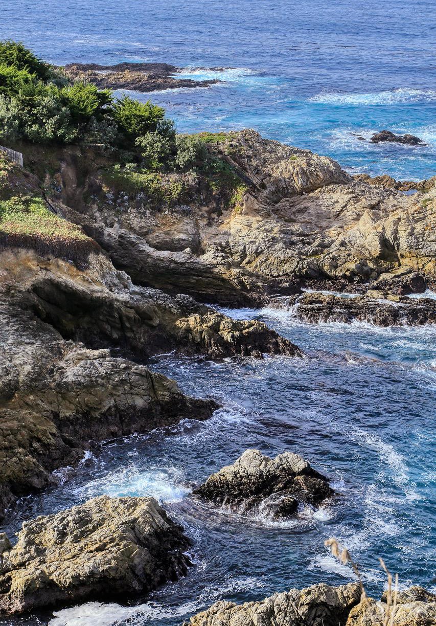 A view of the California coastline is seen looking south from a viewpoint along Highway 1 near Big Sur. The mountainous and rocky shore along the Pacific Ocean creates beautiful and dynamic scenics which are in constant change due to the waves in the ocean and the atmospheric conditions, which also constantly change along the coastline. Photo by Gary Warren/ladailypost.com
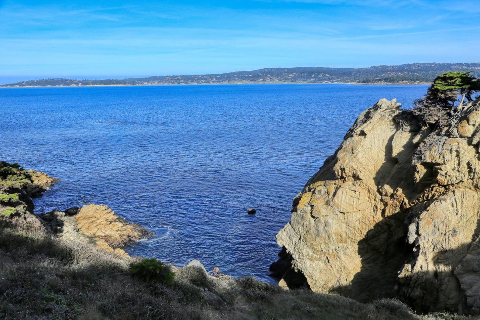 Before driving south toward Big Sur, we spent time exploring Point Lobos State Reserve. Shown is a view from the reserve across the bay towards Carmel-By-the-Sea and Pacific Grove, Calif. Photo by Gary Warren/ladailypost.com