
 Courtesy/LAC
COUNTY News:
A walk-through discussion of the Los Alamos Canyon floodplain assessment will be held at 9:30 a.m. today, Sept. 26. The event is being held in response to citizen concerns raised during the DOE Floodplain Assessment public comment period for the Los Alamos Canyon Creek Watershed Restoration and Sediment Reduction Project.
Participants will have a chance to meet representatives from Los Alamos County, as well as Keystone Restorative Ecology and Natural Channel Design, the consultants leading the project.
The project, a River Stewardship Grant Project, is a partnership between the Los Alamos Department of Public Utilities (DPU) and the New Mexico Environment Department.
The purpose is to fix flow characteristics of the flow channel in the Los Alamos Canyon between the Los Alamos County Reservoir and West Road, and prevent continued damage from future major flood events.
The project area is on property owned by the Department of Energy and Santa Fe National Forest. DPU is managing the grant and the project. Two wildfires, Cerro Grande in 2000 and Las Conchas in 2011, caused runoff rates in the watershed to increase by orders of magnitude and subsequent flooding. The grant project addresses erosion and damage that has already occurred and puts solutions in place to prevent further damage.
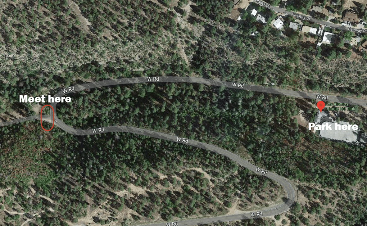
Anyone wishing to attend the walk-through should park at the Los Alamos County Ice Rink and walk to the locked gate at the dirt road to the reservoir. Participants should be prepared to walk about 2 miles. Consultants for the project will present the entire project description.
The comment period for the DOE portion of the floodplain assessment ends today. Project information can be found at https://ladpu.com/floodplain.