
NWS News:
This is a brief update from the National Weather Service in Albuquerque on the potential for severe weather over portions of north central and northwestern New Mexico today, Sunday, Sept. 22.
Impacts:
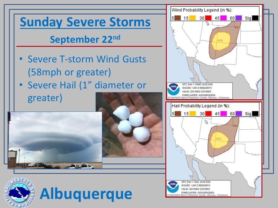
Scattered to numerous thunderstorms are expected to take shape this afternoon over northwestern and north central New Mexico, many of which will be strong to severe. These storms will be capable of producing severe hail (greater than 1″ diameter) and/or severe wind gusts (greater than/equal to 58 mph.)
In addition, breezy to windy conditions will spread over much of New Mexico today.
Overview:
A strong low pressure system will quickly advance toward the Four Corners region today. As this strong system approaches a rather moist and unstable atmosphere over New Mexico, numerous thunderstorms are expected to develop. Conditions will be unstable and prime for strong to severe thunderstorms, including hail and strong to severe outflow winds.
Thunderstorms are expected to quickly move toward the northeast at a brisk pace of 30 to 35 mph which should mitigate the flooding threat. However, there will be locally heavy downpours and the potential for some areas to be impacted periodically by multiple storms. Breezy to windy conditions will also spread over a large majority of New Mexico today (even outside of thunderstorms.)