
 PEEC Amateur Naturalist: Part 3 When White Rock was a Lake
By ROBERT DRYJA
Much of the Pajarito Plateau had been created as a result of two major events that occurred 1.2 and 1.6 million years ago. Volcanic eruptions at these times emptied a lava chamber of an estimated 145 cubic miles of material and created the Valles Caldera.
Part of this material was thrown skyward, eventually to be blown on the eastern side of the Sierra de los Valles mountains. Other material also flowed eastward over these mountains. The resulting layers of lighter or denser lava created the Pajarito Plateau. The magnitude of the layers can be seen on the main highway leading to Los Alamos. Pueblo Canyon can be seen here. The distance from the bottom of the canyon to the top of the adjacent mesa is approximately 450 feet and three major layers stand out.
The Pajarito Plateau is approximately 15 miles wide from the Sierra de los Valles to the Rio Grande. It drops in elevation from 7,200 in Los Alamos to 5,500 feet at the Rio Grande. However, there is a distinct change in the geology as the Rio Grande is approached. The broad layers of salmon or grey colored ash rock are called Bandelier tuff and are a relatively soft rock. It is easy to break with a hammer. However this is replaced by something different as the Rio Grande is approached. A trip down Rendija Canyon brings out this difference.
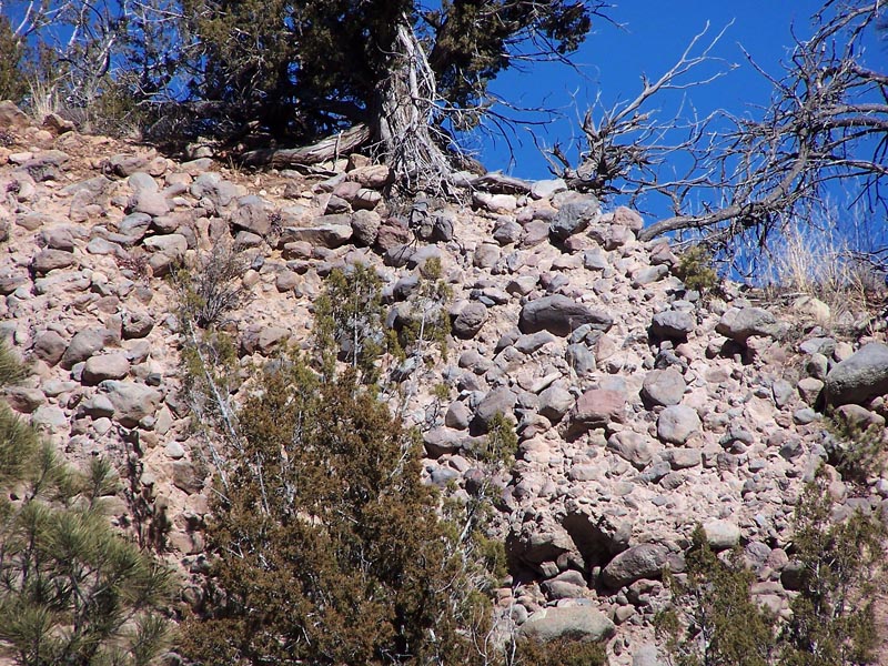
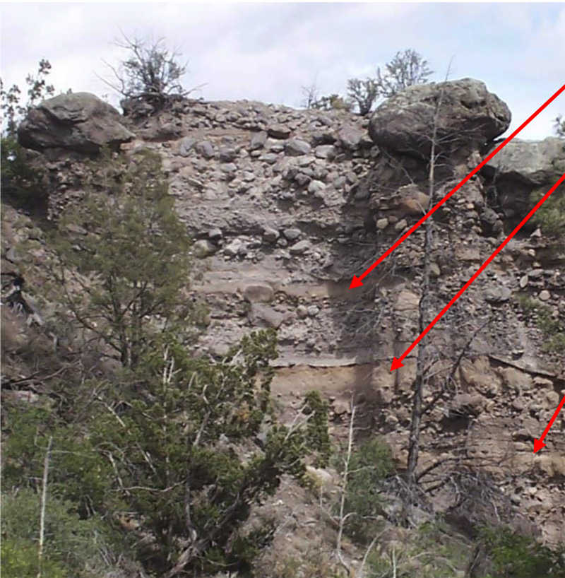
A broad layer of light gray Bandelier tuff is visible beside the road when starting down into Rendija Canyon from Los Alamos from Barranca Mesa. The elevation drops 1,000 feet in the next three miles to where Rendija Canyon joins with Guaje Canyon. The Rendija Canyon has a broad base by the Sportsman Club. It then becomes narrower with steep sides in the next two miles. The rock begins to change at this point. Dark gray to black boulders now appear. This rock is more like basalt and much more difficult to break. Slopes of worn and smooth basaltic cobbles can be seen as well as alternating layers of larger and smaller cobbles. Occasional clay-like layers occur between some of the layers of cobble rock.
This area looks as if it may have been the shore of lake or river. Wave action could have worn broken basaltic rock into smooth cobbles. Waves could have washed clay and sand over the rock from time to time, creating layers. Could the Rio Grande have caused this? But the Rio Grande is about three miles away and about 700 feet lower in elevation. Alternatively, could there have been a lake here and this had been its shore line? Also where did the basaltic rock come from? The answer is several miles away in White Rock on the southeastern side of the Pajarito Plateau.
 Large and small smooth cobbles on a canyon side. Photo by Robert Dryja
 Alternating layers of cobbles with clay layers. Photo by Robert Dryja
A volcanic field called Cerros del Rio exists on the eastern side of the Rio Grande across from White Rock. This field extends to the east and south toward Santa Fe. Unlike the lava that came from the Valles Caldera, the lava that erupted here was in the form of basalt. A major lava flow 2.35 million years ago filled the canyon where the Rio Grande now flows. This lava created a dam in the area where Water Canyon now exists. The resulting lake (called Culebra Lake) extended northward and beyond to what is now Abiquiu. Part of what now is White Rock was under water. The Espanola area was completely underwater and miles from the lake shore. A contour map for this lake shows that its shoreline extended to where the cobbled basaltic rock is found in Rendija Canyon.
 Culebra Lake contour map
This lake drained when the Rio Grande eventually cut a channel through the dam at Water canyon. Other lava flows from the Valles Caldera repeatedly filled the canyon, damming it again and again. Smaller lakes also were created when the sides of White Rock Canyon slumped down into the river. Four smaller lakes that resulted from these slumps into the river have been identified. The last smaller lake existed 12,400 years ago.
Three major geologic events therefore created the Pajarito Plateau. One event started 2.35 million years ago and involved the repeated damming of the Rio Grande. The second and third events involved the creation of the Valles Caldera with eruptions 1.2 and 1.6 million years ago.
This geologic story has not ended with these three events. A third geologic event has been ongoing for the past 1.2 million years following the creation of the Pajarito Plateau. This is the erosion of canyons into what initially was a broad flat plateau. These canyons created the setting for the variety of plant and animal life now found here. The coming of the canyons will be explored in the next article.
 A basaltic cliff face in White Rock Canyon along the Red Dot Trail. Photo by Robert Dryja