
 Image/NWS
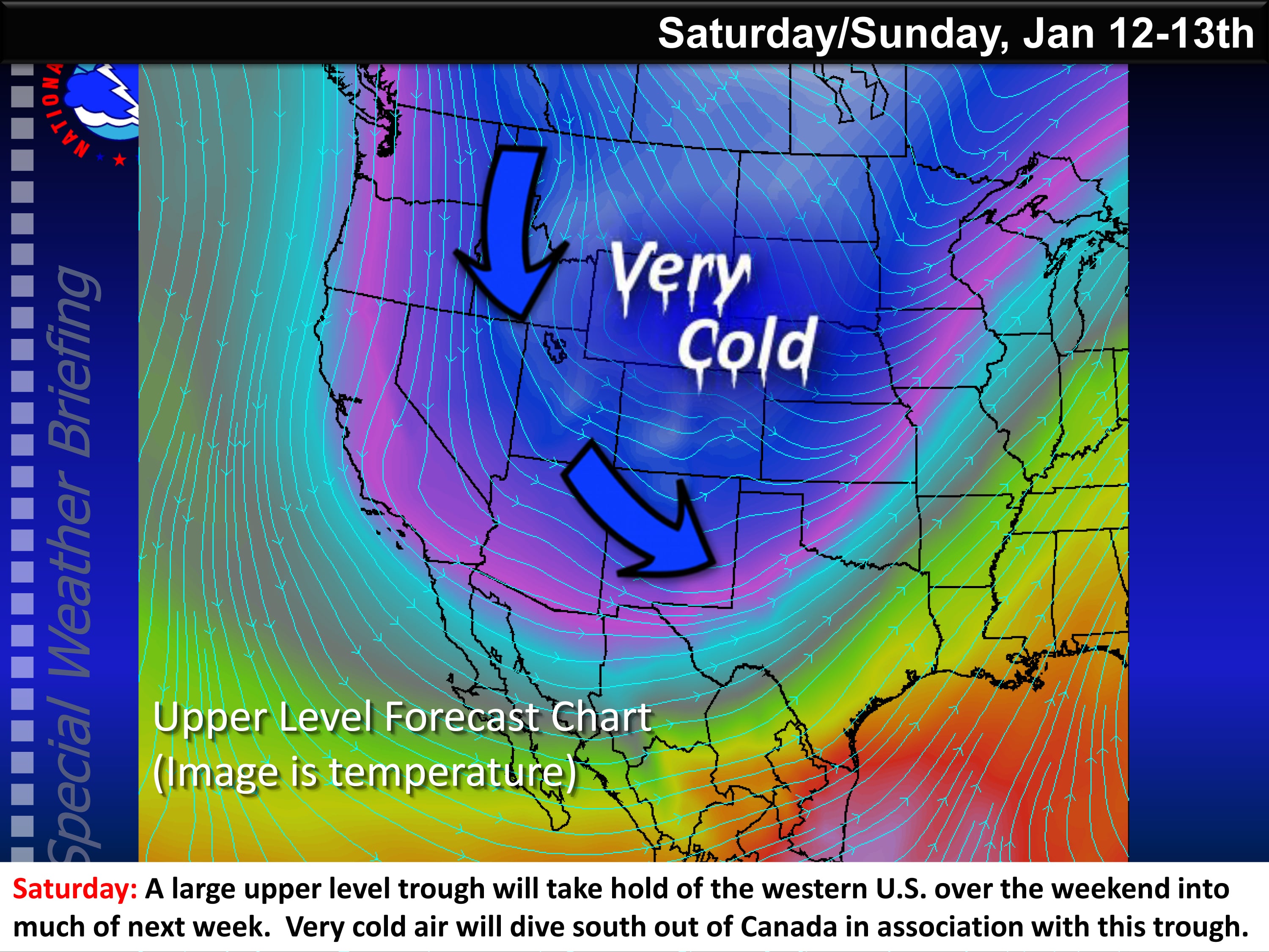
NWS News:
The National Weather Service reports a storm system gathering strength over southern California will move into Arizona Friday then shift across New Mexico Saturday. Rain and snow is expected to develop from west to east over the higher terrain of western New Mexico late tonight then spread into the central high terrain late Friday and Saturday.
At this time, light to moderate snow accumulations are expected over the higher terrain of Catron and Lincoln counties, with lighter amounts along the Continental Divide and within the central mountain chain.
Winter weather to return to portions of the area including the potential for moderate snow impacts for the southwest and south-central mountains.
Timing – Friday p.m. – Saturday a.m.
Location – Moderate snow impacts southwest and south-central higher terrain, with lighter snowfall totals expected for the Continental Divide region and remainder of the central mountain chain. As colder air spreads southward, the potential exists for accumulating snow across lower elevations of northeast New Mexico early Saturday.
Key Impacts:
- Moderate snowfall expected southwest and south-central high terrain with lighter snowfall totals generally expected remainder of the Continental Divide region and central mountain chain.
- Accumulating snowfall possible lower elevations of northeast
- New Mexico on Saturday
- Colder temperatures to end the week with readings 5 to 15 degrees below normal by Saturday