
 Courtesy/NOAA
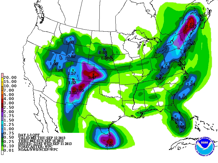
Overview: Record-setting rainfall that impacted much of central New Mexico late Tuesday shifted into eastern New Mexico very early Wednesday. Impacts have been significant including major rises along the Pecos River including the second highest stage (15.1 ft) at Puerto de Luna since the 1930s. Meanwhile, the drying that occurred across western areas Wednesday will be replaced by increased moisture and additional heavy rain potential Thursday-Saturday. In addition to the westward shift of the major league moisture plume, increased chances for thunderstorms are anticipated in the coming days. The active pattern will extend into the weekend before a drier pattern takes hold early next week.
- Heavy rain over eastern NM slowly decreasing in coverage with the focus shifting westward by Thursday. Continued widespread heavy rain potential across the west and north on Friday with quieter conditions EC/SE areas.
- Most significant rises along the entire stretch of the Pecos, Rio Hondo, and Canadian Rivers as well as smaller streams/tributaries that feed these watersheds.
- Mostly isolated coverage this evening and overnight. Better chances areawide Thursday and Friday.
Weather conditions and model forecasts can change rapidly. Interests in northern and central New Mexico are advised to monitor the weather very carefully in case changes occur to the expected weather.