
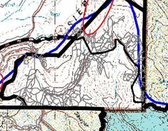
 MAP A: A network of abandoned logging roads are on either side of Highway 4 and extend up the Frijoles creek bed (located within red circle). Photo by Robert Dryja
  Amateur Naturalist
By ROBERT DRYJA
Los Alamos
Cerro Grande Peak: Scene 1- Human and Natural Impacts
The Cerro Grande trail can be considered as a play with five scenes that open up as a person hikes to the top of Cerro Grande peak. The first scene is at the start of the trail.
The ponderosa forest at the start of the trail appears to be in a mature, natural state. However these are not truly mature trees such as can be seen at the Historic Grove in the Valles Caldera. The trees at the start of the Cerro Grande trail look small in comparison to those in the Historic Grove. Indeed, many of these trees have been growing for less than a seventy years whereas the Historic Grove trees may over two hundred years old.
It has been tough to be a ponderosa pine tree at the base of Cerro Grande Peak. A tree could have been burnt down in the Cerro Grande or Las Conchas forest fires in the past eighteen years. Drought conditions also are making life difficult. There is considerable variability, but a large tree may transpire up to 100 gallons of water daily. Trees that have more water available can create more sap. Sap blocks bark beetles from successfully burrowing into trees. However drought conditions mean less water is available for sap. Bark beetles can more successfully burrow into trees, bringing a fungus with them into trees.
Life for the trees had been made even more difficult due to human activity in this area. The Cerro Grande peak and surrounding area were part of the privately owned Baca ranch for much of the last century. This resulted in numerous primitive roads being created as a part of logging operations. The Cerro Grande only became a forest preserve in 1977 when it became a part of Bandelier National Monument. What a life a tree has faced: forest fires, draught, beetles and fungus. Being cut down as a part of logging was the final adversity until recently.
A network of what had been primitive access roads from the logging operations still can be seen. The roads are located on a relatively level landscape. Cut stumps of trees are present. One of these roads can be seen from the present day Cerro Grande trail. Some people still will hike the older trail, closer to the channel of what is the start of Frijoles creek. The creek grows larger and eventually passes the visitor center miles away in Bandelier National Monument.
Scene 2 will be presented in our next essay, considering the forest on the way up the slope of the Cerro Grande trail.
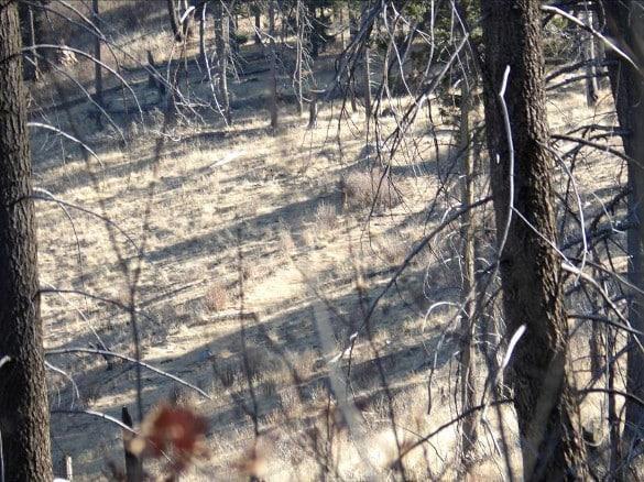 A primitive road passes diagonally through the middle of the picture. It once had been part of a different trail leading to the top of the Cerro Grande.
 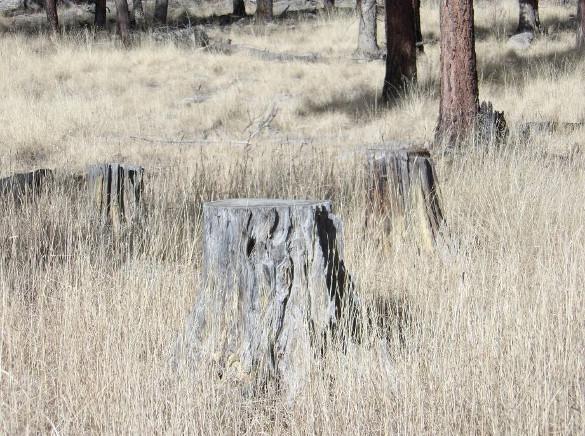 Trees were cut down in the level landscape at the base of the southern flank of the Cerro Grande. The lack trunks lying adjacent to the stumps indicate that the trees had been removed for logging purposes.
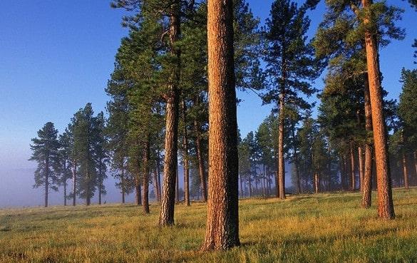 The Historic Grove ponderosa are larger compared to those at Cerro Grande trail head. Photo by Don Usner